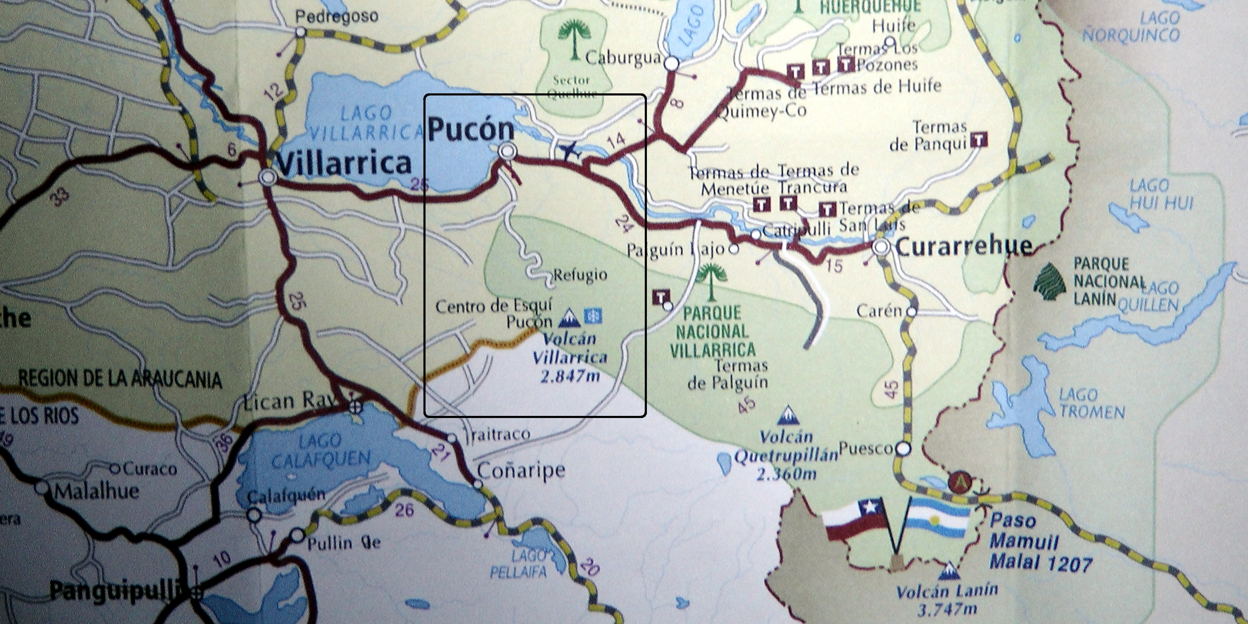
Villarrica Volcano location and Pucón Map in Chile.
The Villarica Volcano located at the South of Chile erupted this Tuesday morning. According to several media new agencies in Chile, the lava intensified around 3 a.m. local time.
Pucon and Conaripe are some of the near towns the volcano, authorities informed the people had been evacuated as a precaution, see map of the location of the volcano.
You can watch the Google/Maps Satellite latest images of the volcano, go to the link.
This are some impressive images from Bernd Andeweg, Earth Scientist from VU University Amsterdam through his account in twitter; @BerndAndeweg.
“@infoVolcano VOLCAN #Villarrica !!! [5] #Chile cr: LagoVillarica pic.twitter.com/WKHYzihTk0” pics keep getting more impressive…
— Bernd Andeweg (@BerndAndeweg) March 3, 2015
Volcán Villarrica en Chile expulsa lava y zonas aledañas evacúan el sector
Las zonas aledañas han sido evacuadas por la explosión del volcán Villarrica, según las autoridades Gubernamentales. Desde las 3 de la mañana los noticieros locales en Chile dieron la noticia, el volcán comenzó con actividad de lava. Puede observarse en las imágenes de Google vía satélite el volcán.
Impactantes imágenes del volcán de Villarrica vía Bio Bio Chile en su cuenta de tuiter; @biobio
Las impactantes imágenes que dejó la erupción del volcán Villarrica http://t.co/X9JvZXQ6Lz pic.twitter.com/y8qwXklQY7 — BioBioChile (@biobio) March 3, 2015


Follow Us!